

Rubrik: Wetter / USA
Format: Spezialbericht
Autor: Sinisa Brkic (sb)
Flash Floods and Severe Storms Threaten New York. New York City and New Jersey face flash floods, severe thunderstorms, damaging winds, hail and an isolated tornado risk
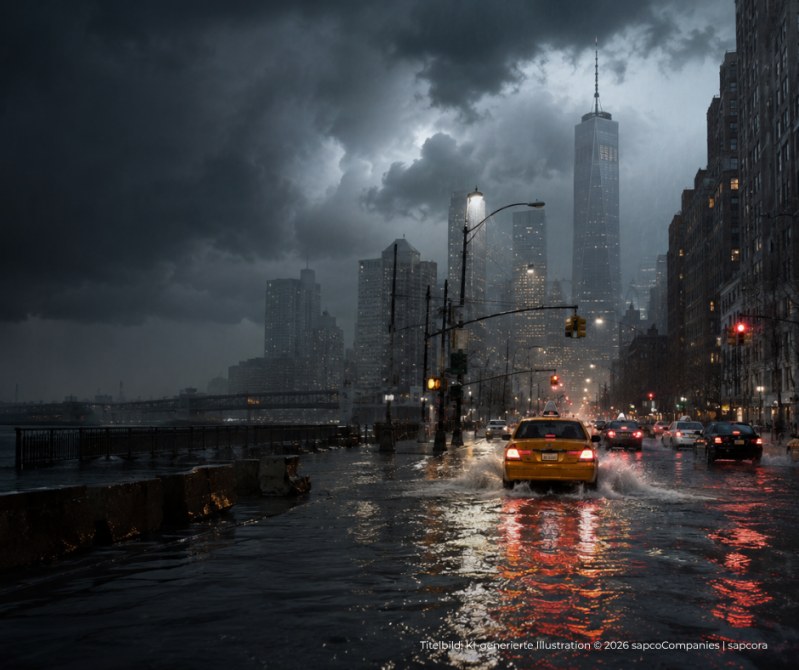
New York City and large parts of the northeastern United States are preparing for severe thunderstorms, torrential rainfall and dangerous flash flooding. Damaging winds, hail and isolated tornadoes are also possible, while roads, public transport and major airports could face significant disruption.
Flash Floods and Severe Storms
New York City, northeastern New Jersey and several parts of the wider US Northeast are preparing for a potentially dangerous period of severe weather. A Flood Watch covers New York City and northeastern New Jersey from Tuesday morning until early Wednesday. Several rounds of thunderstorms could move across the region and produce intense rainfall within a very short period. The wider weather threat stretches across parts of Pennsylvania, Philadelphia, New Jersey, Delaware, Maryland, the Lower Hudson Valley, Long Island and Connecticut.
Most dangerous period expected during the afternoon and evening
The strongest thunderstorms are expected during the afternoon and evening, when atmospheric conditions could become particularly favorable for severe storm development. Forecasters warn that some storms may produce damaging wind gusts, large hail, frequent lightning and isolated tornadoes. Repeated thunderstorms moving across the same locations could also generate extreme rainfall totals and rapid urban flooding. The impact may vary considerably between neighboring communities. One district may experience only heavy rain, while another nearby area could face flooded roads, fallen trees or destructive winds.
Intense rainfall could overwhelm drainage systems
Densely populated urban areas face a particularly high flash-flood risk because large paved surfaces prevent water from draining naturally. Rainfall rates of up to approximately two inches, around five centimeters, per hour are possible in some locations. At this intensity, streets, underpasses, tunnels, subway entrances and basement apartments can flood within minutes. Poorly drained roads, smaller streams and communities along the Interstate 95 corridor are considered especially vulnerable. The immediate danger is expected to come mainly from urban and small-stream flooding rather than widespread flooding along major rivers.
Damaging winds, hail and isolated tornadoes possible
Heavy rainfall is not the only threat. Some thunderstorms could produce wind gusts strong enough to bring down trees, damage buildings and interrupt electricity supplies. Fallen trees and power lines may block roads and affect rail services. Large hail could also damage vehicles, roofs and outdoor equipment. Forecasters additionally warn of an isolated tornado risk across northeastern New Jersey, the New York metropolitan region, Nassau County and the Lower Hudson Valley. A tornado striking New York City is not certain. The current outlook describes atmospheric conditions that could allow tornadoes to develop within individual severe thunderstorms.
New York’s subway and road network could face disruption
New York City’s transport infrastructure is especially vulnerable to intense rainfall. Low-lying roads, underpasses, subway entrances and underground stations can flood rapidly. Water may enter stations even when the wider neighborhood does not appear extensively affected. No systemwide shutdown of the New York subway had been confirmed at the time of publication. Individual lines, stations, bus routes and commuter rail services could nevertheless face delays, temporary closures or diversions. Motorists should never attempt to drive through flooded roads. Water may conceal damaged pavement, open manholes or currents strong enough to move a vehicle.
Major airports prepare for possible delays
Severe thunderstorms across the northeastern United States frequently cause widespread aviation disruption because aircraft must be redirected around dangerous storm cells. John F. Kennedy International Airport, LaGuardia Airport, Newark Liberty International Airport and Philadelphia International Airport could face delayed departures, arrival restrictions, temporary ground stops or flight cancellations. Even flights departing from areas with clear skies may be affected when aircraft, crews or connecting routes pass through the storm zone. Passengers should check their flight status directly with the airline before traveling to the airport.
Philadelphia and New Jersey also face a serious threat
The severe-weather risk extends well beyond New York City. Eastern Pennsylvania, Philadelphia, New Jersey, northern Delaware and parts of Maryland could experience scattered to numerous severe thunderstorms. The strongest storms may bring damaging winds, hail, frequent lightning, flash flooding and several possible tornadoes. The Interstate 95 corridor faces a particularly high risk because heavy rain could affect major roads, rail connections and densely populated communities during the afternoon commuting period.
Further storms remain possible on Wednesday
The severe-weather threat may not end completely overnight. Additional showers and thunderstorms could develop on Wednesday, especially across southern New Jersey, Delaware, Maryland and coastal areas. Regions affected by flooding on Tuesday may remain vulnerable because drainage systems and soils could already be saturated. Conditions are expected to improve gradually, although the timing will depend on the movement and strength of the storm system.
Flood Watch and Flash Flood Warning are not the same
A Flood Watch means that atmospheric conditions could produce flooding. It does not mean that every community within the watch area is already flooded. A Flash Flood Warning represents a more urgent situation. It is issued when dangerous flooding is occurring, has been detected or is expected to begin shortly in a specific area. The status of individual locations may therefore change rapidly throughout the day. Residents should keep emergency notifications activated and monitor warnings from the National Weather Service and local authorities.
Residents should prepare for rapidly changing conditions
People across New York, New Jersey, Pennsylvania, Delaware and surrounding regions should secure loose outdoor objects before the strongest storms arrive. Vehicles should be moved away from flood-prone streets and large trees where possible. Residents of basement or below-street-level apartments should pay close attention to Flash Flood Warnings and be prepared to move to a higher floor. Anyone who hears thunder should move indoors. During damaging winds or hail, people should remain away from windows and seek shelter inside a substantial building.
If a Tornado Warning is issued, residents should move to a small interior room on the lowest available floor and remain away from windows. The most dangerous period for New York City and surrounding areas is expected during Tuesday afternoon and evening. Conditions may change within minutes as individual storms develop and move across the region.
Kommentar hinzufügen
Kommentare